


QUICK FACTS
Link Copied!

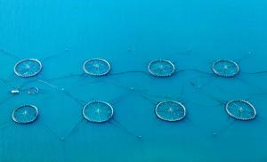
Main industries: fishing and aquaculture, shipping and offshore services, tourism, and petroleum prospects in the Faroese area
Currency: Faroese króna (DKK)
Exchange rate: £1 = 8.58kr, US$1 = 6.28kr, €1 = 7.47kr (February 2026)
International telephone code: +298
Internet TLD: .fo
Time: GMT (winter); GMT+1 (summer)
Electrical voltage: 220V; European two-pin plugs
Weights and measures: Metric
Flag: Red cross fringed with blue on white background
Public holidays: New Year’s Day 1 January, Maundy Thursday, Good Friday, Easter Sunday, Easter Monday, Flag Day 25 April, Common Prayers’ Day (May), Ascension Day, Whit Sunday, Whit Monday, Ólavsøka 28-29 July, Christmas 24-26 December, New Year’s Eve 31 December
Frequently asked questions
Where are the Faroe Islands located?
The Faroe Islands are located in the North Atlantic Ocean, in the middle of the Gulf Stream, halfway between Scotland and Iceland. The archipelago lies at 62º00’N and 06º47’W, with the closest neighbouring land being North Rona in Scotland’s Outer Hebrides.
Where are Faroe Islands in relation to Europe?
If you’re wondering where are Faroe Islands in a European context, they are situated northwest of mainland Europe, between Norway, Scotland, and Iceland. The islands are part of the Kingdom of Denmark but operate as a self-governing region.
What is the Faroe Islands population?
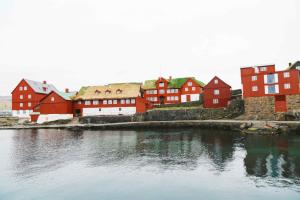
The Faroe Islands population is 56,365 people as of February 2026. Nearly half of the population lives in and around the capital, Tórshavn, which has a population of 22,711.
How many islands make up the Faroe Islands?
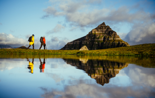
The Faroe Islands consist of 18 volcanic islands, separated by narrow sounds and fjords. All but one of the islands are inhabited, and no point on the islands is more than 5 km from the sea.
Are the Faroe Islands part of Denmark?
Yes, the Faroe Islands are a self-governing region within the Kingdom of Denmark. They have their own parliamentary democracy, official language (Faroese), and government, while Denmark handles certain foreign and defence matters.